Driving Directions between Checkpoints
Start Line – Redding, CA
- Address: 725 Sundial Bridge Dr, Redding, CA 96001
- Driving distance from Start Line to Checkpoint #1: 19 miles
Driving Directions from Start Line to Checkpoint #1
-
- Drive Southeast on Sundial Bridge Drive
- Turn LEFT onto Park Marina Drive
- LEFT onto CA – 44 E towards I-5
- Merge onto I-5 South, continue for approximately 10.5 miles
- Take the Deschutes Road Exit
- LEFT onto Factory Outlets Drive
- At traffic circle, take 2nd exit onto Deschutes Road, continue for 2 miles
- Turn RIGHT onto Balls Ferry Road, continue 3 miles
- Turn LEFT onto Ash Creek Road, continue 1 mile
- Cross the Sacramento River, checkpoint #1 will be immediately on the right
Checkpoint #1 – Anderson, CA
- Address: Intersection of Ash Creek Rd & Gover Rd, Anderson, CA 96007
- Driving distance from Checkpoint #1 to Checkpoint #2: 21.8 miles
Driving Directions from Checkpoint #1 to Checkpoint #2
-
- Cross the Sacramento river and drive West on Ash Creek Rd, continue 1 mile
- Turn LEFT onto Balls Ferry Rd, continue 3.7 miles
- Turn RIGHT onto 4th street, continue 1 mile
- Turn LEFT to merge onto I-5 South, continue approximately 15 miles
- Take the CA-36/Antelope BLVD exit #649 towards Central Red Bluff/CA-99/Chico
- Follow CA-36 W/Antelope Blvd to Main St (about 1 mile)
- Turn LEFT onto Main St. River will be on the left, going south.
- Checkpoint #2 is on the pebble beach behind the restrooms behind the Red Bluff Chamber of Commerce, which is at 100 Main Street, Red Bluff, CA 96080
Checkpoint #2 – Red Bluff, CA
- Address: Red Bluff River Park, 98 Main St., Red Bluff, CA 96080 (search for Red Bluff Chamber of Commerce)
- Driving distance from Checkpoint #2 to Checkpoint #3: 24.5 miles
Driving Directions from Checkpoint #2 to Checkpoint #3
-
- Leave Red Bluff River Park, head back out to Main St.
- Turn LEFT on Main St.
- Merge onto I-5 South, continue for 17.4 miles
- Take the South Ave exit in Corning
- Turn LEFT onto South ave, continue 6 miles
- Cross the Sacramento River, turn LEFT into Tehama County River Park parking area
- Checkpoint #3 is on the beach, just north of the bridge
Checkpoint #3 – Corning, CA
- Address: Tehama County River Park, Corning, CA 96021
- Driving distance from Checkpoint #3 – Finish: 19 miles
Driving Directions from Checkpoint #3 to Finish
-
- Turn right onto South Road out of Tehama County River Park, drive Northeast (you don’t cross the Sac River), continue 3.4 miles
- Turn RIGHT onto CA-99 South, continue 6.5 miles
- Turn RIGHT onto Hamilton Nord Cana Highway, continue 5.4 miles
- Continue Straight onto Folsom street
- Slight LEFT onto Market street
- Continue on Hamilton Nord Cana Highway for 1.7 miles
- Turn RIGHT onto CA-32 West, continue .6 miles
- First LEFT onto River Road, continue 1.4 miles
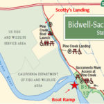
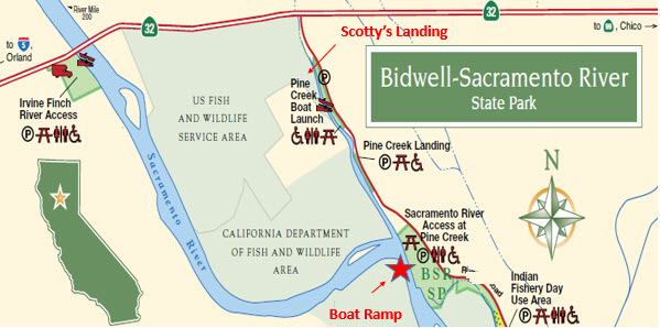
- Finish is on right side at Bidwell Sacramento River State Park, Pine Creek Access, just past Scotty’s Landing
- Checkpoint #3 is on river bank at northwest corner of parking area
Finish – Chico, CA
- Bidwell-Sacramento State Park, Pine Creek Access
- Address: 12429 River Road, Chico, CA 95973
May 27, 2019 – Celebration Lunch Location
- Sierra Nevada Big Room
- 1075 E 20th St, Chico, CA 95928